Training Log Archive: dbakkerIn the 7 days ending Jul 31, 2020:
| |||||||||||||||||||||||||||||||||||||||||||||||||||||||||||||||||||||||||||||||
| « | » |
| » now | ||||||||||
| Sa | Su | Mo | Tu | We | Th | Fr | |||||||
Friday Jul 31, 2020 #
Note
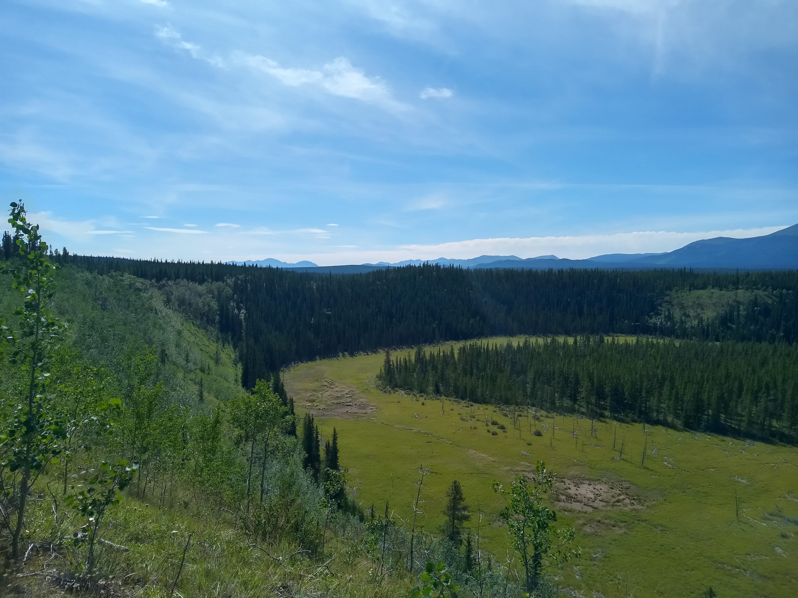
Beautiful day out mapping today.
I have had worse offices :)
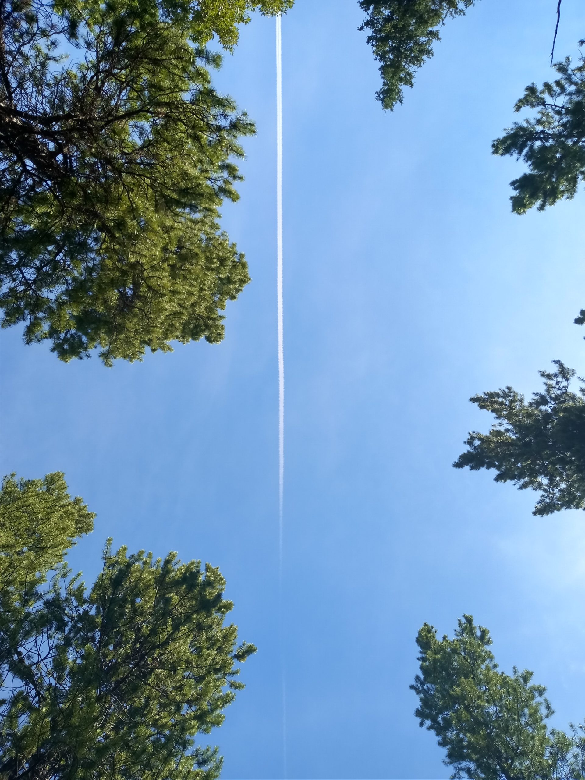
Just a little bit too late to catch the plane actually flying over in the shot - should have taken a drink break 2 minutes earlier

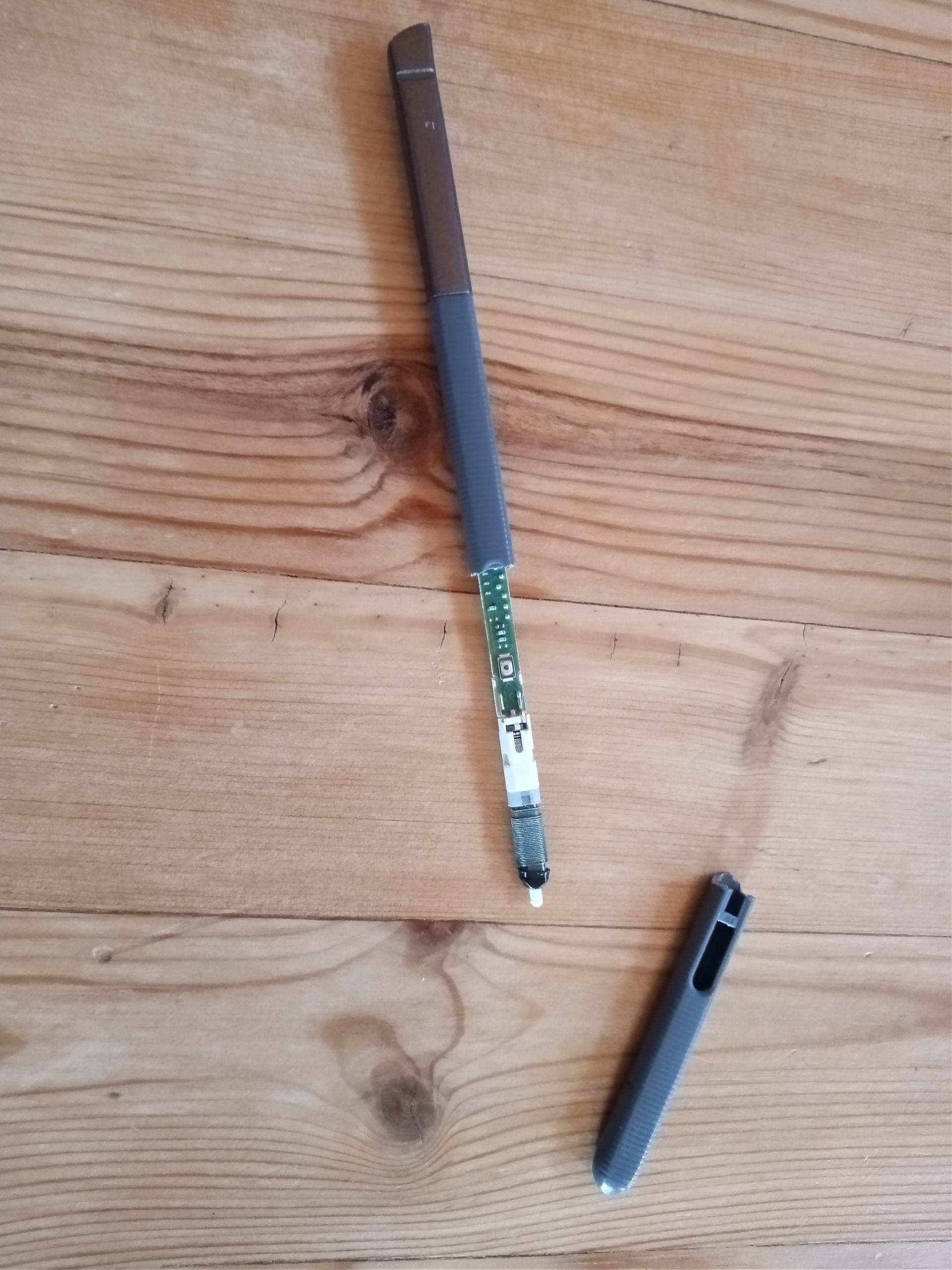
It got it's duck tape! Along with about 1/3 of a safety pin, some durabond, and three high end toothpicks. No longer fits in its slot in the tablet, but worked like a charm mapping today. Replacement stylus to fill the hole in the tablet ordered and due to arrive on August 10th.
I have had worse offices :)
Just a little bit too late to catch the plane actually flying over in the shot - should have taken a drink break 2 minutes earlier
It got it's duck tape! Along with about 1/3 of a safety pin, some durabond, and three high end toothpicks. No longer fits in its slot in the tablet, but worked like a charm mapping today. Replacement stylus to fill the hole in the tablet ordered and due to arrive on August 10th.
Wednesday Jul 29, 2020 #
Note
Disaster struck while mapping today:
It Ain't Broke - It Just Lacks Duct Tape
I slipped on a wet log on a sidehill and ate it (like the third of fourth time this year while mapping, so nothing out of the ordinary), but unfortunately snapped my magnetic tablet stylus in the process. The electronics of it still work, but even after 10 minutes of searching I could not find the piece of plastic that was the button.
I think tonight is going to be some scrounging around the McLean's house trying to find some sturdy wire (or maybe some unused needles?), glue, and duct tape to try and cobble it back together again, ideally without damaging the electronics further.
There are still two replacement styluses (styli?) on Amazon for this device (it is from 2015), but looking at a week to get either of them up here and neither are official (one has decent reviews though).
Sunday Jul 26, 2020 #
5 PM
Running 30:31 4.2 km (7:16 / km) +38m 6:57 / km
ahr:139 max:165
Running with Luna (the McLean's dog) while Bruce is away.
Checked out a potential map expansion for Golden Horn. Some decent terrain, but too small of an area to be used on its own, and there is the Alaska Highway separating it from the rest of the map.
Checked out a potential map expansion for Golden Horn. Some decent terrain, but too small of an area to be used on its own, and there is the Alaska Highway separating it from the rest of the map.
Saturday Jul 25, 2020 #
11 AM
Biking 1:00:54 [1] 6.74 km (9:02 / km) +399m 6:58 / km
Ride In from the Carcross Highway to the trapper's cabin. Normally part of the hike, but I got some local info (thanks Caelen and Colin) that it was worth riding this part (including walking a ~350m long hill in the middle). Took a brief wrong turn before correcting.
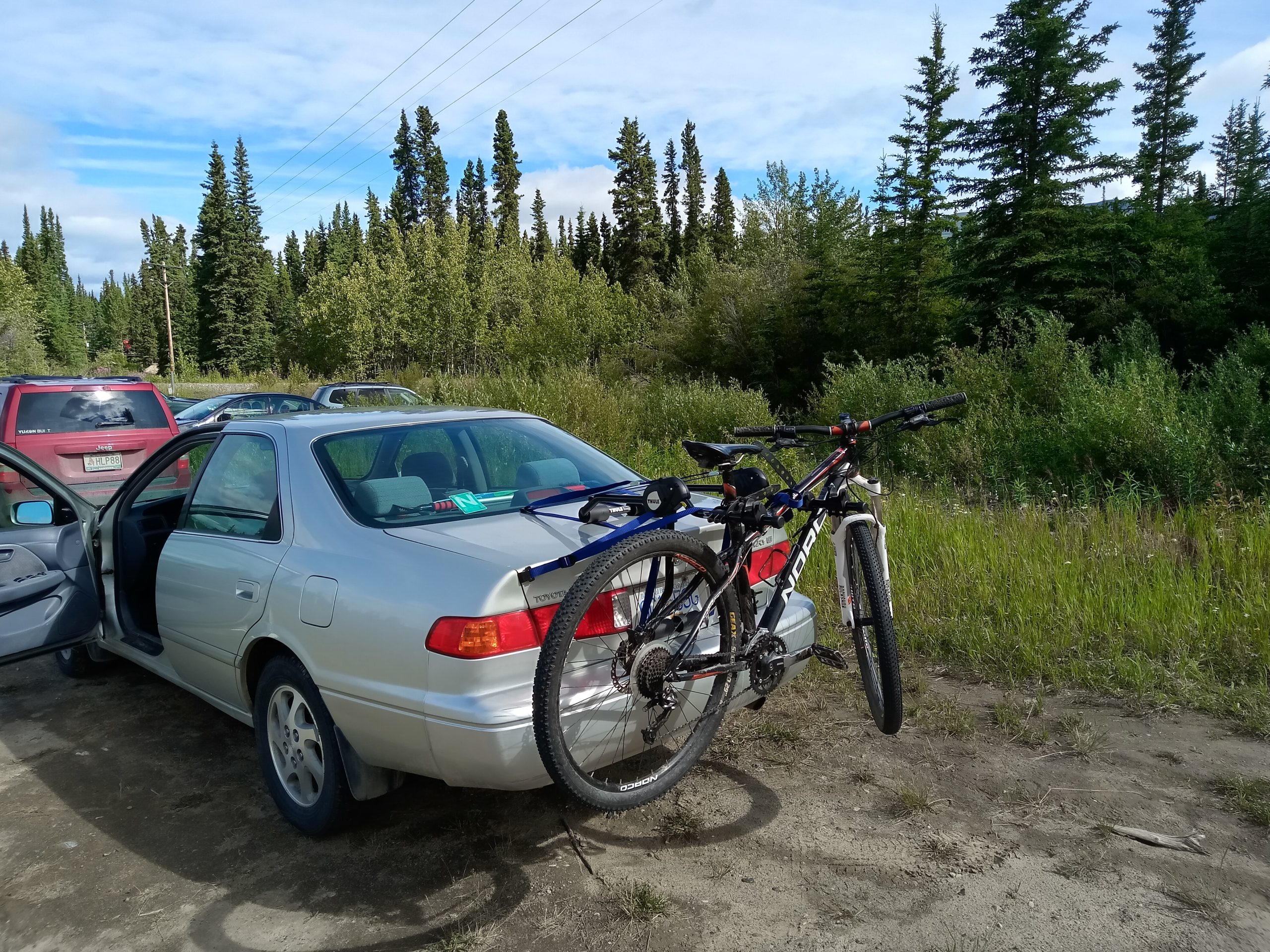
Using the new bike rack.
Using the new bike rack.
12 PM
Hiking 4:06:29 12.55 km (19:39 / km) +995m 14:04 / km
Hiking Mount Lorne part 2. Nice circular hike route. Gonna really feel this one tomorrow. Lots of scrambling on all fours and figuring out routes along skinny rocky ridges with drops on both sides. Groups ahead and behind me made me feel a little more comfortable knowing that someone would know my body would be down there if I fell off. Hamstring briefly cramped up when extending a leg down to the next ledge while I was hanging mostly from my hands which was a bit scary, but there it was a pretty wide part of the ridge and was fine.
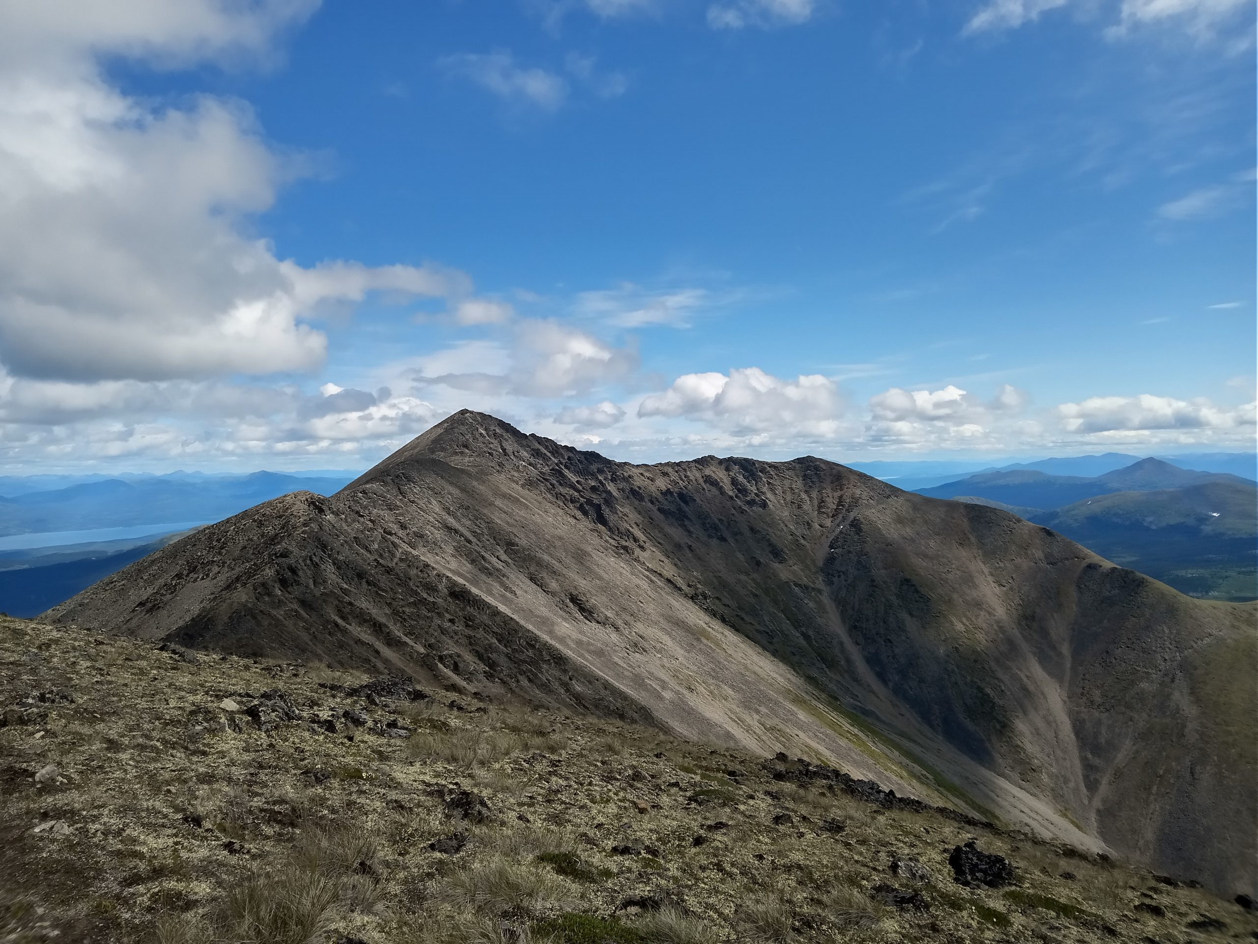
Looking from the sub summit up to the top along the second (of three) scramble ridges.
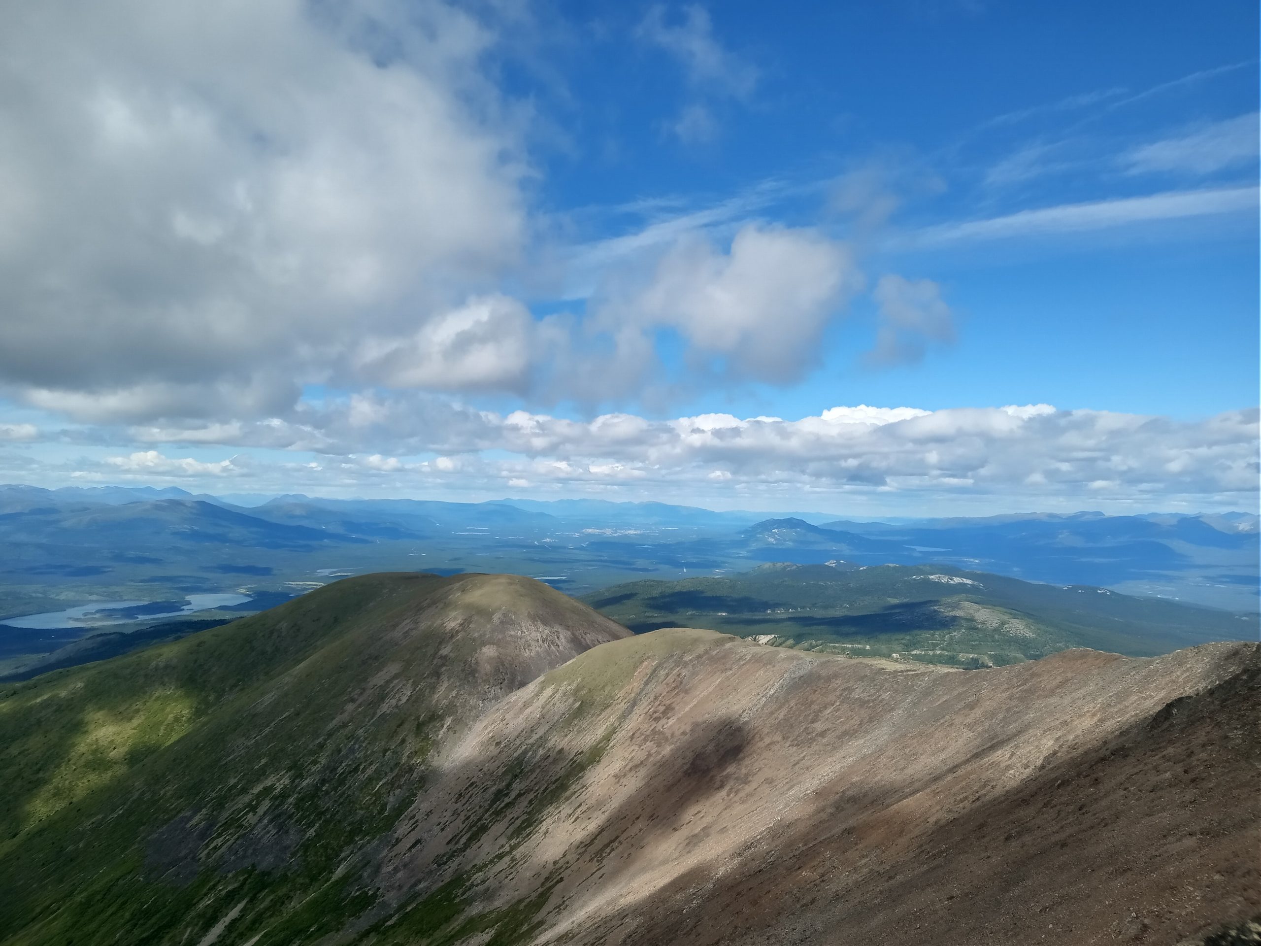
Looking north-west down at Whitehorse and Grey Mountain.
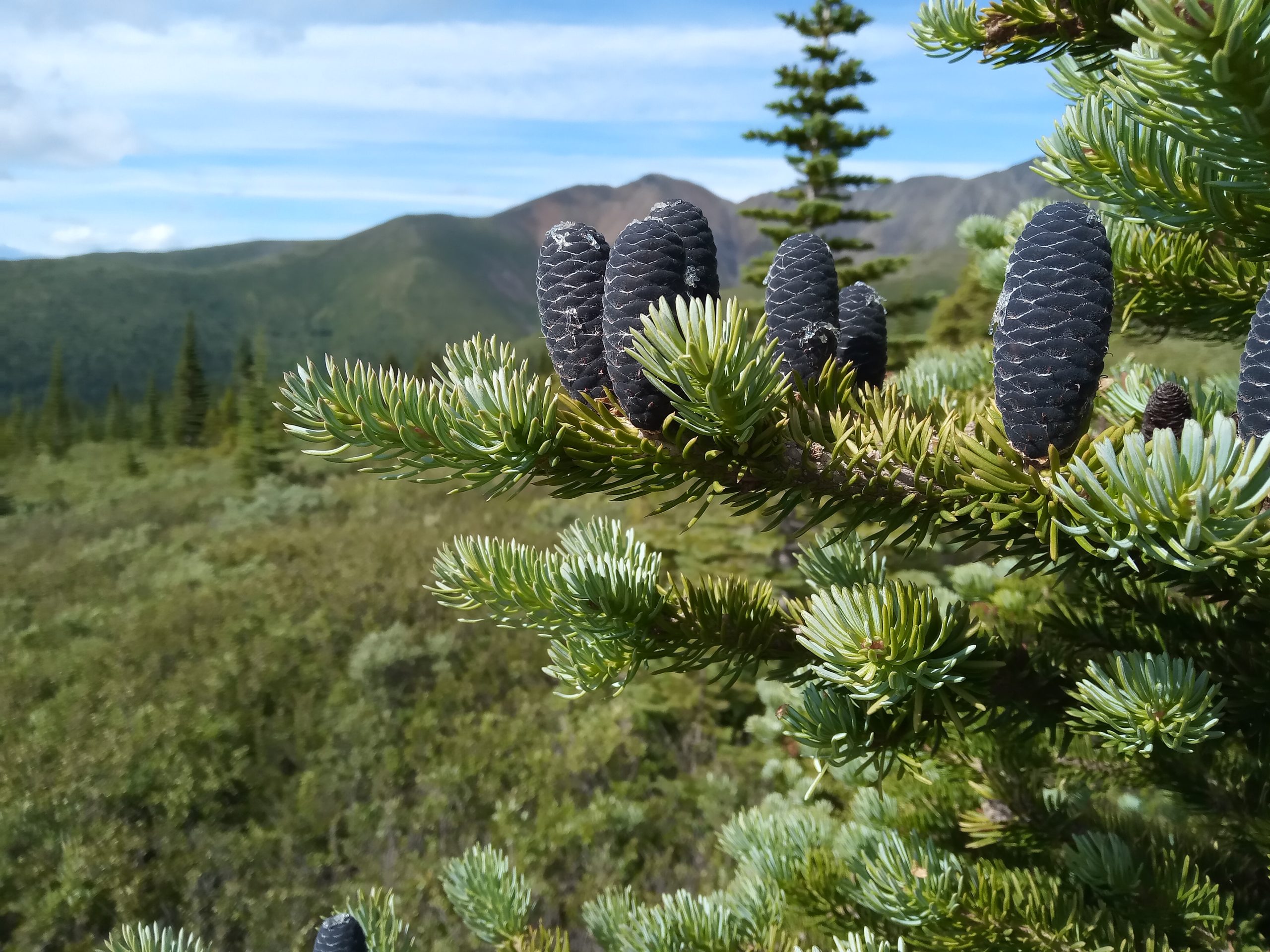
Any idea why this species of spruce (?) have their pinecones extending up from the branch instead of down which is typical for other spruces (and firs - which this might be instead)?
Looking from the sub summit up to the top along the second (of three) scramble ridges.
Looking north-west down at Whitehorse and Grey Mountain.
Any idea why this species of spruce (?) have their pinecones extending up from the branch instead of down which is typical for other spruces (and firs - which this might be instead)?
5 PM
Biking 25:54 [1] 5.78 km (4:29 / km) +1m 4:29 / km
Riding Back Out - and seriously missing full suspension as my legs were dead tired and there lots of roots on this almost non-stop downhill.