Training Log Archive: BashIn the 2 days ending May 6, 2012:
| ||||||||||||||||||||||||||||||||||||||||
| « | » |
| » now | |||||
| Sa | Su | |||||||
Sunday May 6, 2012 #
12 AM
Orienteering race (Rogaine) 11:55:00 71.0 km (10:04 / km)
shoes: Salomon XA Pro - Navy 2nd pair
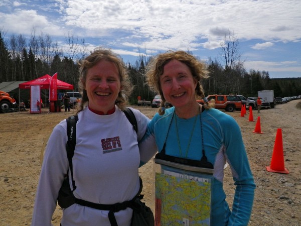
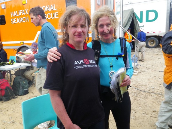
The Eco-Endurance Challenge, a fundraiser for Halifax Search and Rescue, is the only annual 24-hour rogaine in Canada. I was keen to go back after having a great time last year but it proved challenging to find an experienced teammate who could get to Nova Scotia. I'd pretty much given up until two weeks ago when GHOSLO mentioned that Pam James had moved home to Halifax. She wasn't on the registration list so I wrote her and crossed my fingers and - yay! - she was in. Pam, aka Pamtastic, has one of the best track records of any rogainer in Canada, including a world championship (female category) and a North American championship (overall). She also spent years competing on Canada's national orienteering team. So she's way out of my league as a navigator, although I figured that my adventure racing experience with less detailed 1:50,000 maps would be useful. She warned me that she hadn't been training for long events lately but I knew she'd be fine.
Pam's Mom kindly cooked up a wonderful Nova Scotia style pre-race dinner for several of us who were staying at their place.
I had a great pre-race sleep - an unexpected treat since I usually lie awake staring at the ceiling with my mind in high gear. Pam and I got to registration at 7:45 a.m., picked up coffee and snacks, then headed to the race site to work on our maps in the car. There were 60 controls but only 43 were marked on the main map. We knew 6 controls worth 70 points each would be on a larger scale aerial photo map that we would receive after the mandatory gear check, and we knew where that map fit on our main map. There were some controls where we were just given grid references with no control descriptions and we had to plot their locations. Some other controls were described in terms of their distance/bearing from a marked control, again without control descriptions. So there was a fair bit of work to get the map ready before we could plan our course. Luckily, we had a couple of hours before the race briefing.
We used a 60 km piece of string to measure straight line distance between controls. By the time we got the aerial map, I think we were optimistically planning a little more than 60 km. We should have known better in this terrain. The density of points was high on the east side of the map so we planned to head there first. The start/finish was in the south/centre part of the map and we planned a counterclockwise loop.
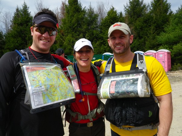
A few other Ontarians had traveled east this year. Mr. and Mrs. GHOSLO were at the starting line.
So were Bender and Relentless.
Some east coast Attackpoint AR friends were there too - O9Man, Lori and NSAR.
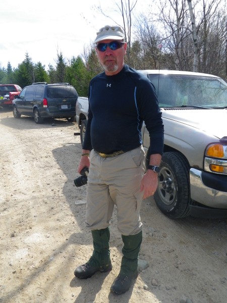
Here's Jim Blanchard, the course designer. We saw him a couple of times on the race course.
My Attackpoint report from last year's race had been posted on the event website, and it was fun to meet a few people who said hello when they recognized me from the photos. As always, lots of people said hi to Pam; that girl knows everyone!
The sun was warm and black flies had just emerged. Luckily, they were only swarming, not biting.

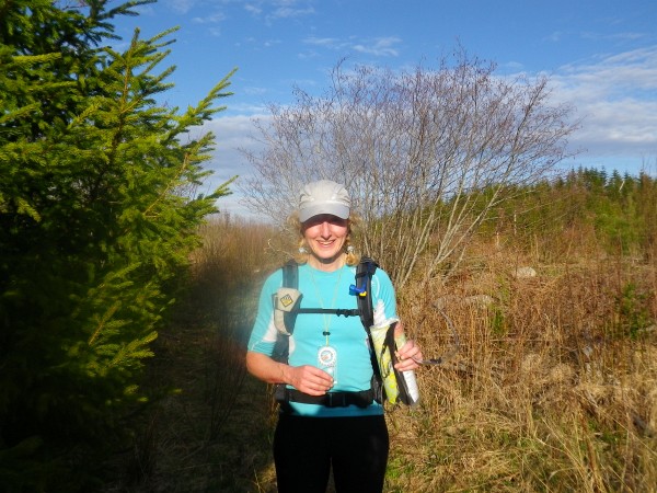
At the start, my pack was almost 10 lb heavier than Pam's - yikes! With 2L of water, food for 24 hours, all the team gear (1st aid, spare compass, etc.), bright bike lights, spare batteries and extra layers, it was close to 19 lb. The temperature was forecast to drop from 15C down to 5C, which wasn't bad but I couldn't shake memories of last year when Crash and I wore virtually everything in our packs during the coldest, wettest hours of the night. It turns out Pam has a built-in heat generator. By the middle of the night, I needed several warm layers and a toque but she was fine wearing - and eating - much less. I'm used to wearing a pack though, so it wasn't an issue.
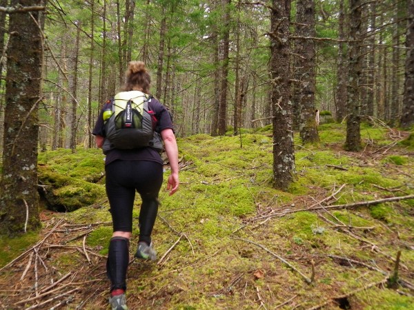
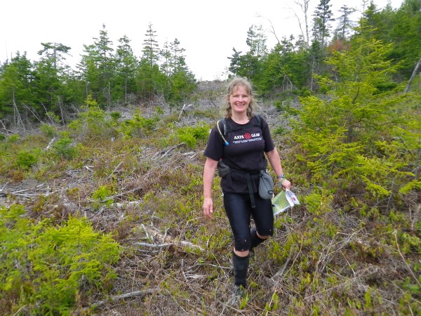
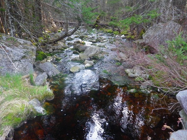
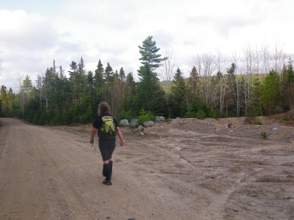
We used the first few controls to get used to the map and get a feeling for our rate of travel. Roads and trails are almost always faster than bushwhacking, but in this terrain, the difference is magnified. In places, the forest was thick with rootstocks and thigh-high fallen logs, and there were often small cliffs to slide down. In a few places, it was relatively open and beautifully mossy - a fairytale forest.
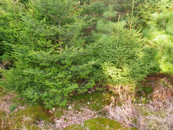
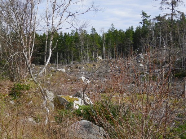
The older clearcuts weren't too bad to walk though but the newer ones could be a tangled mess of pointy branches and stumps. On the plus side, we had better visibility across the newer clearcuts if they weren't too hilly. Older clearcuts sometimes had trees growing in them and it could take some effort to distinguish them from forested land.
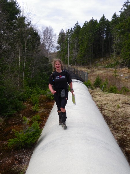
The easiest terrain of the day was this big water pipe we ran on.
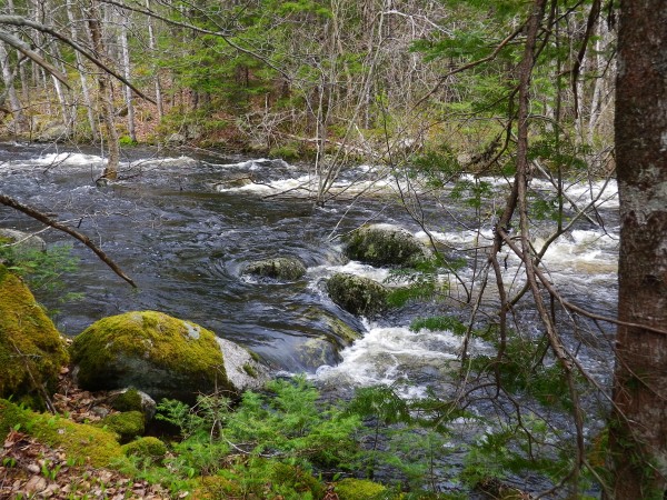
When we reached the southeast part of the map, we hit a flooded, fast-moving river right before a road. We had to do a wide detour to reach a bridge.
From there, we headed up to 240, which was the first of a group of distance/bearing controls. Attached to the flag for 240 was a card with a distance and bearing to 241, then when we found that flag, there was a card with distance/bearing to 237. The three controls were worth a lot of points but were hard to account for in our planning, since we didn't know the distances until we got there. They weren't difficult though.
Pam and I had planned that we would navigate together so we talked aloud about what we were seeing and thinking. We have some different skills because of our backgrounds. As one of Canada's best orienteers, Pam reads features easily and can seemingly follow a bearing by magic. My engineer-ish habit of tracking distances using time or pace count was useful in this terrain, as was my experience with the quirks of 1:50,000 maps. With practice, we could do a better job of working together and taking advantage of our respective strengths but for our first time as a team, things worked pretty well and we found all the controls we looked for.
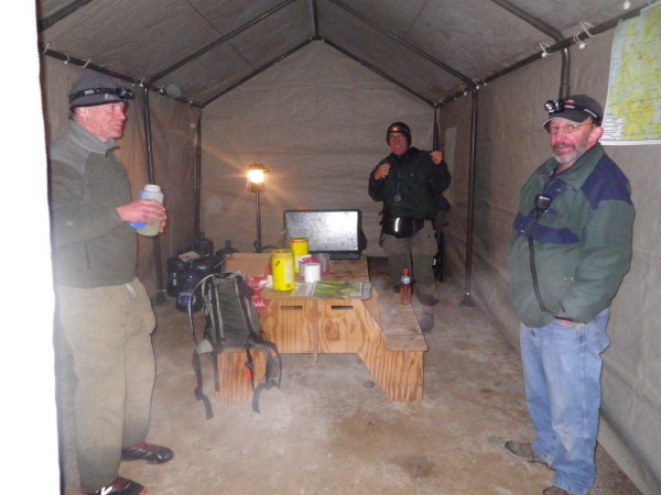
We worked our way north to Annapolis Trail Safety Camp - our first stop to replenish water. There were several safety camps distributed across the map where groups of volunteers camped for the night, enjoyed a bonfire, sometimes shared treats like hot chocolate, and recorded the teams that passed through. They always asked which control we had come from and which one we were going to. One fellow said this was a check on whether teams knew what they were doing. In addition to the safety camps, there were people in trucks and ATVs patrolling some of the roads on a regular basis, and these patrolled road sections were marked on our map. So the volunteers took very good care of us!
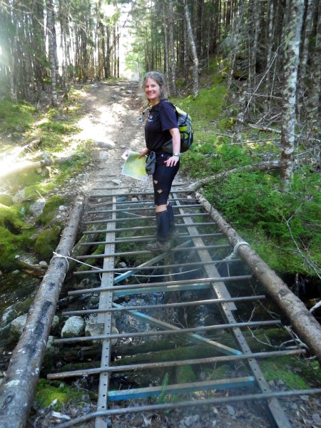
Pam was brave to charge across this trail bridge near 218 - and stop in the middle for a photo!
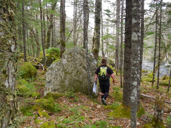
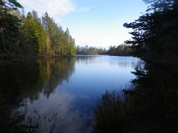
We stumbled upon some beautiful places.
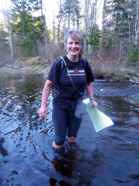
As the sun set and the temperature fell, we were wading through a chilly river. I remembered doing this crossing with Crash in last year's race.
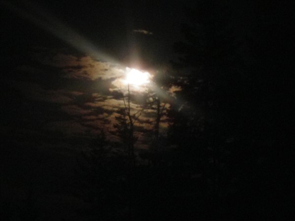
We finally had to pull our lights out around 214. When it got really dark, the "supermoon" came out - a full moon happening at the time when the moon and earth are closest together, causing the moon to appear larger and brighter than usual. It really was incredibly beautiful. It was so bright that we kept thinking another team was coming up behind us with big headlamps. We were able to use this spectacular moonlight to see outlines of hills, glimmers of lakes and other navigational clues. It was an absolutely wonderful night to be outside.
I had been eating ravenously - a race habit I've been working on. I'd brought two 12-hour bags of food and finished the first bag before the 12 hour mark, so I took a short break from eating just in case! My appetite waned overnight and I still finished with plenty of food as I always do. After getting light-headed in my 50-miler, I've been trying to take in more calories.
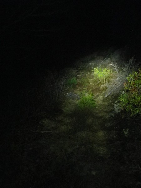
Other than the moon, this was our view during the hours of darkness. My Night Lightning medium battery lasted most of the night.
The sky started to brighten shortly after 210. Sunday was going to be a gorgeous day. We headed toward Burntwoods Brook Safety Camp shortly after sunrise.
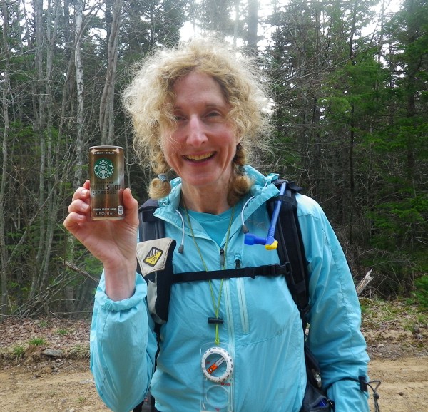
I'm not a morning person, and when I'm not doing these crazy races, I don't see dawn very often. Here's one of my luxuries in overnight races - canned double espresso with cream. Goes down so well!
Until 7 a.m., we had visited every control in our plan but now it was time to figure out a reasonable route to the finish, which meant dropping some controls we'd pencilled into the most optimistic version of our route. This is where we messed up by heading down toward the aerial photo map. Considering our combined rogaining experience, we should have known better; this was a huge mistake. The controls in that area looked relatively easy and close together, plus they were reasonably valuable at 70 points each. But the bushwhacking was as slow as any we'd seen.
Heading to 136, we'd planned to take a trail from the main road but were unable to find it at the right curve in the road. With the clock ticking, we should have abandoned the control and headed for a different one, but instead we began a laborious 400 m bushwhack (and bog-whack). It was no trouble to find the flag but it was hard work. Since we were in there, we also picked up 163, then had a slow slog through a clearcut to the road.
We had promised ourselves that we wouldn't get rushed at the end - but now it was too late. We had to push hard for more than two hours, ignoring nearby controls as we made our dash for the finish. There was a significant, tough bushwhack to reach the road to the finish, and that made it tough to guess whether we would make it. When we finally hit the road, we had to run for 50 minutes with some speed hiking on the uphills. The only good thing about this part of the day was realizing that I felt OK running after 23 hours on my feet; I guess the Canadian Death Race will feel similar.
We finished with about 8 minutes to spare - phew! We'd messed up in the last 5 hours, getting a grand total of just 3 controls, but we had a great 19-hour rogaine. :)
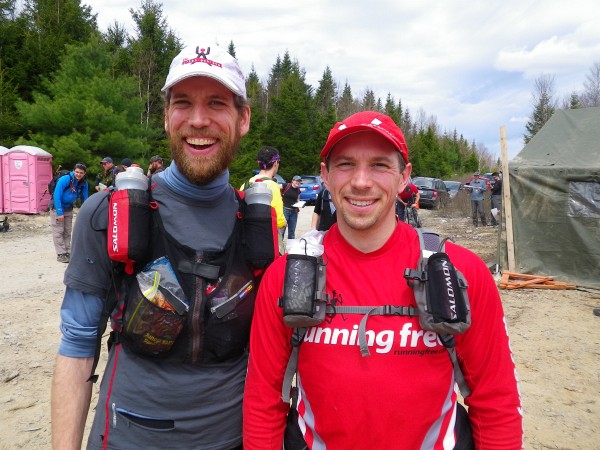
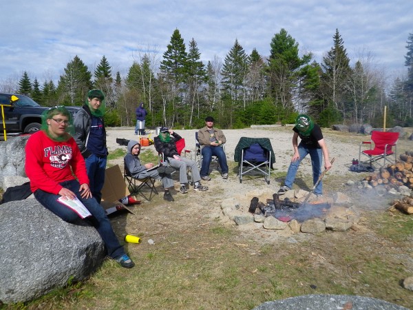
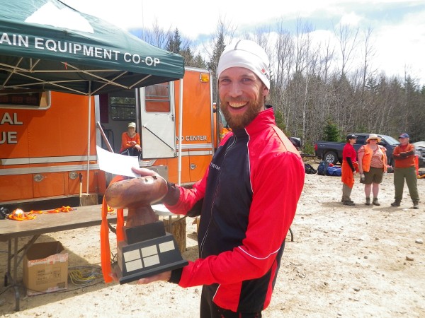
We were 7th overall of 61 teams in different divisions of the 24-hour event with 2900 points of 4500 available, and 34 of 60 controls. (Official results say 33 controls but it was 34.) The big excitement was that Bender and Relentless took the win, including this great trophy and a $1,000 cheque! Unfortunately, Relentless slept through the awards ceremony but Bender's big smile made up for it.
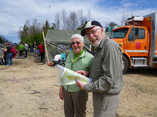
Mrs. and Mrs. GHOSLO got an honourable mention for finishing solidly in the mid-pack. Great job! The post-race meal was a nice barbecue with fish chowder and corn chowder - yum! There were also some excellent cookies from a local baker. Once again, it was a very well-organized event with an interesting and challenging race course. So glad I was able to take part again! Interestingly, it wasn't as hard on my body as rogaines usually are. I think the combination of ultrarun training and course testing with Getawaystix has been good preparation. I just wish there were more 24-hour rogaines to do.
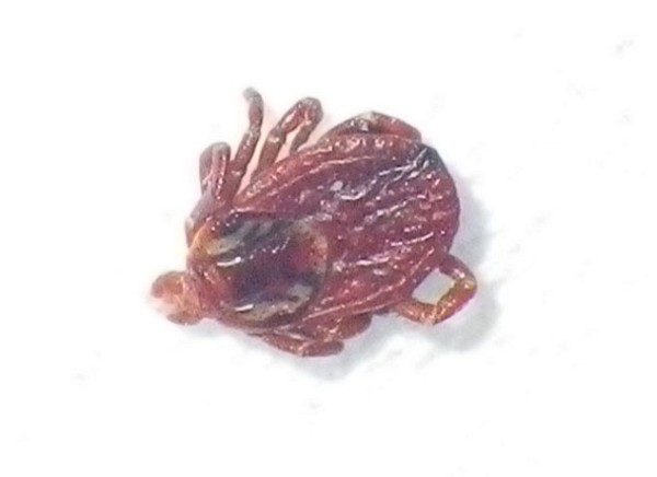
The only negative was that a number of us found a tick or three crawling on our bodies or - in my case - embedded in my back after the race. I've never had a tick before nor even seen one on a human until Pam pulled one off her neck during the race. It's an experience I've both been dreading and wanting to get over with. I managed not to freak out and Pam was a hero with my tick removal tweezers. Here's the offender - a brown dog tick, if Google is right. It's more likely to carry Rocky Mountain Spotted Fever than Lyme - not really a huge plus. Hopefully, the tick population in Nova Scotia doesn't have a high rate of infection.
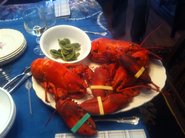
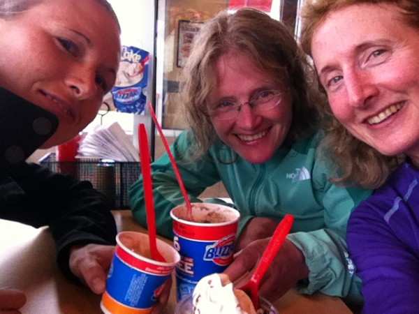
We corrected a mistake we made last year by going to Dairy Queen *immediately* after leaving the race site.
Thanks to the organizers and volunteers for a terrific race, and thanks to Pam for being an awesome teammate!
For those interested in our route:
126 243 248 232 240 241 237 250 262 235 229 230 218 217 216 222 215 214 - DARK - 221 228 213 212 211 197 223 207 208 209 210 - LIGHT - 205 224 131 136 163
Pam's Mom kindly cooked up a wonderful Nova Scotia style pre-race dinner for several of us who were staying at their place.
I had a great pre-race sleep - an unexpected treat since I usually lie awake staring at the ceiling with my mind in high gear. Pam and I got to registration at 7:45 a.m., picked up coffee and snacks, then headed to the race site to work on our maps in the car. There were 60 controls but only 43 were marked on the main map. We knew 6 controls worth 70 points each would be on a larger scale aerial photo map that we would receive after the mandatory gear check, and we knew where that map fit on our main map. There were some controls where we were just given grid references with no control descriptions and we had to plot their locations. Some other controls were described in terms of their distance/bearing from a marked control, again without control descriptions. So there was a fair bit of work to get the map ready before we could plan our course. Luckily, we had a couple of hours before the race briefing.
We used a 60 km piece of string to measure straight line distance between controls. By the time we got the aerial map, I think we were optimistically planning a little more than 60 km. We should have known better in this terrain. The density of points was high on the east side of the map so we planned to head there first. The start/finish was in the south/centre part of the map and we planned a counterclockwise loop.
A few other Ontarians had traveled east this year. Mr. and Mrs. GHOSLO were at the starting line.
So were Bender and Relentless.
Some east coast Attackpoint AR friends were there too - O9Man, Lori and NSAR.
Here's Jim Blanchard, the course designer. We saw him a couple of times on the race course.
My Attackpoint report from last year's race had been posted on the event website, and it was fun to meet a few people who said hello when they recognized me from the photos. As always, lots of people said hi to Pam; that girl knows everyone!
The sun was warm and black flies had just emerged. Luckily, they were only swarming, not biting.
At the start, my pack was almost 10 lb heavier than Pam's - yikes! With 2L of water, food for 24 hours, all the team gear (1st aid, spare compass, etc.), bright bike lights, spare batteries and extra layers, it was close to 19 lb. The temperature was forecast to drop from 15C down to 5C, which wasn't bad but I couldn't shake memories of last year when Crash and I wore virtually everything in our packs during the coldest, wettest hours of the night. It turns out Pam has a built-in heat generator. By the middle of the night, I needed several warm layers and a toque but she was fine wearing - and eating - much less. I'm used to wearing a pack though, so it wasn't an issue.
We used the first few controls to get used to the map and get a feeling for our rate of travel. Roads and trails are almost always faster than bushwhacking, but in this terrain, the difference is magnified. In places, the forest was thick with rootstocks and thigh-high fallen logs, and there were often small cliffs to slide down. In a few places, it was relatively open and beautifully mossy - a fairytale forest.
The older clearcuts weren't too bad to walk though but the newer ones could be a tangled mess of pointy branches and stumps. On the plus side, we had better visibility across the newer clearcuts if they weren't too hilly. Older clearcuts sometimes had trees growing in them and it could take some effort to distinguish them from forested land.
The easiest terrain of the day was this big water pipe we ran on.
When we reached the southeast part of the map, we hit a flooded, fast-moving river right before a road. We had to do a wide detour to reach a bridge.
From there, we headed up to 240, which was the first of a group of distance/bearing controls. Attached to the flag for 240 was a card with a distance and bearing to 241, then when we found that flag, there was a card with distance/bearing to 237. The three controls were worth a lot of points but were hard to account for in our planning, since we didn't know the distances until we got there. They weren't difficult though.
Pam and I had planned that we would navigate together so we talked aloud about what we were seeing and thinking. We have some different skills because of our backgrounds. As one of Canada's best orienteers, Pam reads features easily and can seemingly follow a bearing by magic. My engineer-ish habit of tracking distances using time or pace count was useful in this terrain, as was my experience with the quirks of 1:50,000 maps. With practice, we could do a better job of working together and taking advantage of our respective strengths but for our first time as a team, things worked pretty well and we found all the controls we looked for.
We worked our way north to Annapolis Trail Safety Camp - our first stop to replenish water. There were several safety camps distributed across the map where groups of volunteers camped for the night, enjoyed a bonfire, sometimes shared treats like hot chocolate, and recorded the teams that passed through. They always asked which control we had come from and which one we were going to. One fellow said this was a check on whether teams knew what they were doing. In addition to the safety camps, there were people in trucks and ATVs patrolling some of the roads on a regular basis, and these patrolled road sections were marked on our map. So the volunteers took very good care of us!
Pam was brave to charge across this trail bridge near 218 - and stop in the middle for a photo!
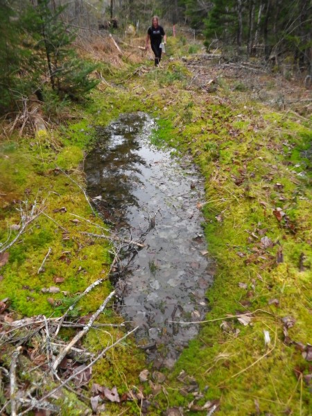
We stumbled upon some beautiful places.
As the sun set and the temperature fell, we were wading through a chilly river. I remembered doing this crossing with Crash in last year's race.
We finally had to pull our lights out around 214. When it got really dark, the "supermoon" came out - a full moon happening at the time when the moon and earth are closest together, causing the moon to appear larger and brighter than usual. It really was incredibly beautiful. It was so bright that we kept thinking another team was coming up behind us with big headlamps. We were able to use this spectacular moonlight to see outlines of hills, glimmers of lakes and other navigational clues. It was an absolutely wonderful night to be outside.
I had been eating ravenously - a race habit I've been working on. I'd brought two 12-hour bags of food and finished the first bag before the 12 hour mark, so I took a short break from eating just in case! My appetite waned overnight and I still finished with plenty of food as I always do. After getting light-headed in my 50-miler, I've been trying to take in more calories.
Other than the moon, this was our view during the hours of darkness. My Night Lightning medium battery lasted most of the night.
The sky started to brighten shortly after 210. Sunday was going to be a gorgeous day. We headed toward Burntwoods Brook Safety Camp shortly after sunrise.
I'm not a morning person, and when I'm not doing these crazy races, I don't see dawn very often. Here's one of my luxuries in overnight races - canned double espresso with cream. Goes down so well!
Until 7 a.m., we had visited every control in our plan but now it was time to figure out a reasonable route to the finish, which meant dropping some controls we'd pencilled into the most optimistic version of our route. This is where we messed up by heading down toward the aerial photo map. Considering our combined rogaining experience, we should have known better; this was a huge mistake. The controls in that area looked relatively easy and close together, plus they were reasonably valuable at 70 points each. But the bushwhacking was as slow as any we'd seen.
Heading to 136, we'd planned to take a trail from the main road but were unable to find it at the right curve in the road. With the clock ticking, we should have abandoned the control and headed for a different one, but instead we began a laborious 400 m bushwhack (and bog-whack). It was no trouble to find the flag but it was hard work. Since we were in there, we also picked up 163, then had a slow slog through a clearcut to the road.
We had promised ourselves that we wouldn't get rushed at the end - but now it was too late. We had to push hard for more than two hours, ignoring nearby controls as we made our dash for the finish. There was a significant, tough bushwhack to reach the road to the finish, and that made it tough to guess whether we would make it. When we finally hit the road, we had to run for 50 minutes with some speed hiking on the uphills. The only good thing about this part of the day was realizing that I felt OK running after 23 hours on my feet; I guess the Canadian Death Race will feel similar.
We finished with about 8 minutes to spare - phew! We'd messed up in the last 5 hours, getting a grand total of just 3 controls, but we had a great 19-hour rogaine. :)
We were 7th overall of 61 teams in different divisions of the 24-hour event with 2900 points of 4500 available, and 34 of 60 controls. (Official results say 33 controls but it was 34.) The big excitement was that Bender and Relentless took the win, including this great trophy and a $1,000 cheque! Unfortunately, Relentless slept through the awards ceremony but Bender's big smile made up for it.
Mrs. and Mrs. GHOSLO got an honourable mention for finishing solidly in the mid-pack. Great job! The post-race meal was a nice barbecue with fish chowder and corn chowder - yum! There were also some excellent cookies from a local baker. Once again, it was a very well-organized event with an interesting and challenging race course. So glad I was able to take part again! Interestingly, it wasn't as hard on my body as rogaines usually are. I think the combination of ultrarun training and course testing with Getawaystix has been good preparation. I just wish there were more 24-hour rogaines to do.
The only negative was that a number of us found a tick or three crawling on our bodies or - in my case - embedded in my back after the race. I've never had a tick before nor even seen one on a human until Pam pulled one off her neck during the race. It's an experience I've both been dreading and wanting to get over with. I managed not to freak out and Pam was a hero with my tick removal tweezers. Here's the offender - a brown dog tick, if Google is right. It's more likely to carry Rocky Mountain Spotted Fever than Lyme - not really a huge plus. Hopefully, the tick population in Nova Scotia doesn't have a high rate of infection.
We corrected a mistake we made last year by going to Dairy Queen *immediately* after leaving the race site.
Thanks to the organizers and volunteers for a terrific race, and thanks to Pam for being an awesome teammate!
For those interested in our route:
126 243 248 232 240 241 237 250 262 235 229 230 218 217 216 222 215 214 - DARK - 221 228 213 212 211 197 223 207 208 209 210 - LIGHT - 205 224 131 136 163
Saturday May 5, 2012 #
Event: Eco-Endurance Challenge 2012
12 PM
Orienteering race (Rogaine) 12:00:00
shoes: Salomon XA Pro - Navy 2nd pair